Hiking & Bushwalking Trails
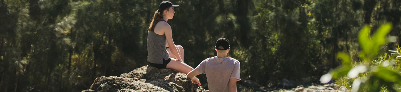 Surrounded by natural wonder, our region boasts many bushwalks for all fitness levels.
Lace up your boots and hit the trails
Hiking through national parks surrounding the region will delight the fittest bush walker or those just out for an overnight caravan or camp spot. We've put together our list of the best hikes and bush walks around Rockhampton and its surrounds.
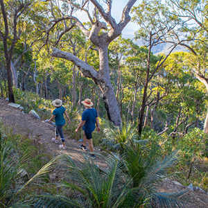
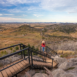
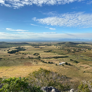
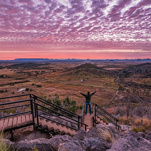
Mount Archer (Nurim) National Park
Directions to Mount Archer National Park
Many walking and hiking tracks of varying difficulty in Mount Archer (Nurim) National Park provides a challenge for early morning and late afternoon fitness fanatics, with their efforts rewarded by stunning views and gentle breezes on the way up or down the summit.>
- Nurim Circuit| Easy, wheelchair accessible | 500m distance, allow 20 minutes
- Bracken Fern Way | Easy | 1.4km return, allow 45 minutes
- Sleipner Lookout Walk | Moderate | 2.4km return, allow 1 hour
- Zamia Walk | Difficult | 14km one way, allow up to 5 hours
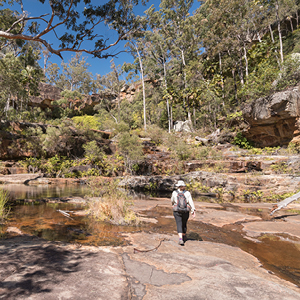
Mount Etna Caves National Park
Directions to Mount Etna Caves National Park
Self-guided and guided tours take you through dry rainforest ecosystem and limestone caves and outcrops. You can even take a Bat Cleft Tour along the Mount Etna Walk, and learn about one of the largest maternity sites for little bent-wing bats. The Mount Etna Walk is closed to independent walkers from 1 November to the end of February for bat breeding season. You can still take the Bat Cleft Tour during this time.
Tip: the viewing platform above is on the Mount Etna Walk. To get to this walk, you need to travel along Rossmoya Road and turn left after the sign. See the National Parks map for further directions.
- Cammoo Circuit| Easy | 600m distance, allow 45 minutes
- Mount Etna Walk | Moderate | 2.4km return, allow 1 hour
- Bat Cleft Tours | Moderate | 2.4km return, allow 3 hours
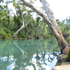
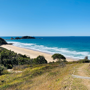
Byfield National Park
Directions to Byfield National Park
Just one hour's drive north east of Rockhampton, you'll find yourself surrounded by stunning rainforest with clear, cold creeks and waterholes, coastal scenery, sand dunes and remote camping spots. Most picnic spots and walks are easily reached but some areas are 4WD only. Check out the Byfield Discovery Guide for a full list of hikes, camp grounds and 4WD tracks.
- Venusta Circuit, Upper Stoney| Easy | 900m return, allow 20 minutes
- Stoney Creek Circuit, Upper Stoney | Moderate-difficult | 4.3km return, allow 4 hours
- Bowenia Rainforest Circuit, Water Park Creek | Easy | 1.2km return, allow 30 minutes
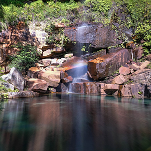
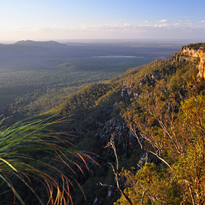
Blackdown Tableland National Park
Directions to Blackdown Tableland National Park
Two hours drive west of Rockhampton will take you to Blackdown Tableland National Park located in the Central Highlands. Here you will find deep gorges, breath-taking lookouts and dreamy waterfalls. The Blackdown Tablelannd is the traditional home of the Ghungalu people. It is within this national park that you will come across rock faces displaying traditional Ghungalu artwork - a vivid reminder of their special culture to this area.
The national park features a number of walking and hiking tracks to enjoy including the Gudda Gumoo Walk, which provides one of the most spectacular and rewarding views of a water fall and watering holes at the end of it's 2km hike (one way).
This walk requires a moderate to high fitness level, particularly for the lookout walk, which involves short, steep slopes, stairs and loose surfaces and the gorge walk, which includes 240 stairs leading to the base of the waterfall. Be sure to allow yourself at least 90 minutes for the lookout return walk, or two hours for the gorge return walk.
- Goon Goon Dina Wal| Moderate | 2.5km return, allow 1.5 hours
- Mook Mook Walk | Moderate-difficult | 1.2km one way, allow 25 minutes
- Gudda Gumoo Walk | Difficult | 1.8km one way to the lookout, allow 45 minutes | 2km one way to the water, allow 1 hour
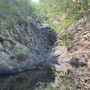
Bouldercombe Gorge Resource Reserve
Directions to Bouldercombe Gorge Resource Reserve
Just a 25 minute drive south west of Rockhampton is Bouldercombe Gorge Falls. This Reserve trail is a 2.7km lightly trafficked outback trail that features a waterfall and is recommended for very experienced adventurers.